


A massive tropical wave forming off the American coastline has hurricane trackers on high alert – with Florida potentially getting hit next.
The tropical wave, named Invest 97L by the National Hurricane Center (NHC), now has a 70 percent chance of development, and may potentially evolve into a full-blown hurricane.
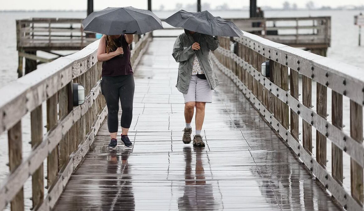
The system is currently dumping rain on Hispaniola, Puerto Rico, and the Virgin Islands. But its sights may soon be set on the Sunshine State.
Meteorologist George Waldenberger told Channel 9 News it most likely will develop this weekend or early next week.
‘For now, expect a higher chance of heavier rains Sunday, Monday and possibly beyond,’ he said. ‘Strong storms may be possible with this disturbance nearby in the same time frame.’

A massive tropical wave forming off the American coastline has hurricane trackers on high alert – with Florida potentially getting hit next

The tropical wave, named Invest 97L by the National Hurricane Center (NHC), now has a 70 percent chance of development, and may potentially evolve into a full-blown hurricane

Waldenberger said he is still ‘watching to see where circulation emerges and how organized this system can become by early next week.’
‘Water temperatures are in the upper 80s, adding plenty of fuel for this system to grow into Debby – possibly even a hurricane by late weekend and early next week near our west coast,’ Chief meteorologist Tom Terry told Channel 9 News Thursday morning.
‘Heavy rain and worse (is possible) with this scenario for the Sunshine State,’ he added.
The tropical rainstorm currently lacks a well-defined center but shows signs of organizing as it moves towards Florida.
Meteorologists expect the storm to strengthen as it moves away from Cuba, with warm waters potentially fueling it’s wrath from late weekend to early next week.
The tropical storm has already drenched northern Caribbean islands and is set to soak Cuba and the western Bahamas by Friday.

The system is currently dumping rain on Hispaniola, Puerto Rico, and the Virgin Islands. But its sights may soon be set on the Sunshine State (Pictured: rain storm at Veteran’s Memorial Marina Park on Thursday, July 11, 2024, in downtown Safety Harbor)

A woman walks along the beach of Manresa, covered with garbage after the passage of Hurricane Beryl, in Santo Domingo, Dominican Republic, 3 July 2024

Damaged boats lie on the land and water in the aftermath of Hurricane Ian, Thursday, Sept. 29, 2022, in Fort Myers, Fla

Cubans repair a roof in San Juan y Martinez, Pinar del Rio Province, on September 27, 2022 after the passage of Hurricane Ian
Florida’s forecast calls for downpours and gusty thunderstorms to hit the Keys and southern peninsula by Saturday, with an increased risk of tropical storm or hurricane conditions from Sunday onwards, AccuWeather reported.
The exact track of the storm remains uncertain. It could hit Florida’s east coast or veer into the Gulf of Mexico, depending on how quickly it intensifies.
This comes after at least eight people died and more than 2.7 million were left without power when Hurricane Beryl swept into Texas and up the Mississippi valley at the start of the month.
And after weeks of relative calm the National Hurricane Center (NHC) has warned that its successor, named Debby, could be brewing east of the Lesser Antilles.
‘The chances of tropical development have bumped up to 40 percent within seven days,’ tweeted the Texas Storm Chasers.

A contractor surveys a Dallas-based client’s home for structure damage after Hurricane Beryl moved through the area in Galveston, Texas on July 8, 2024
‘Folks anywhere along any part of the Florida coastline ought to keep an eye on this. August looks busy as it tends to often be!’
The NHC first raised the alarm on Friday after spotting the tropical disturbance and seeing it was likely to clash with an approaching tropical wave.
The chances of it developing have nearly tripled since then with Weather Jamaica issuing a code Orange and warning that ‘Debby is imminent’.
Forecast maps show the storm sweeping across the Caribbean and across Florida if it develops, but warn it could make land anywhere in the Gulf of Mexico or the Carolinas.
A large area of high pressure near Bermuda could force it into Texas while another over the southern plains could force it up the eastern seaboard.