Topline
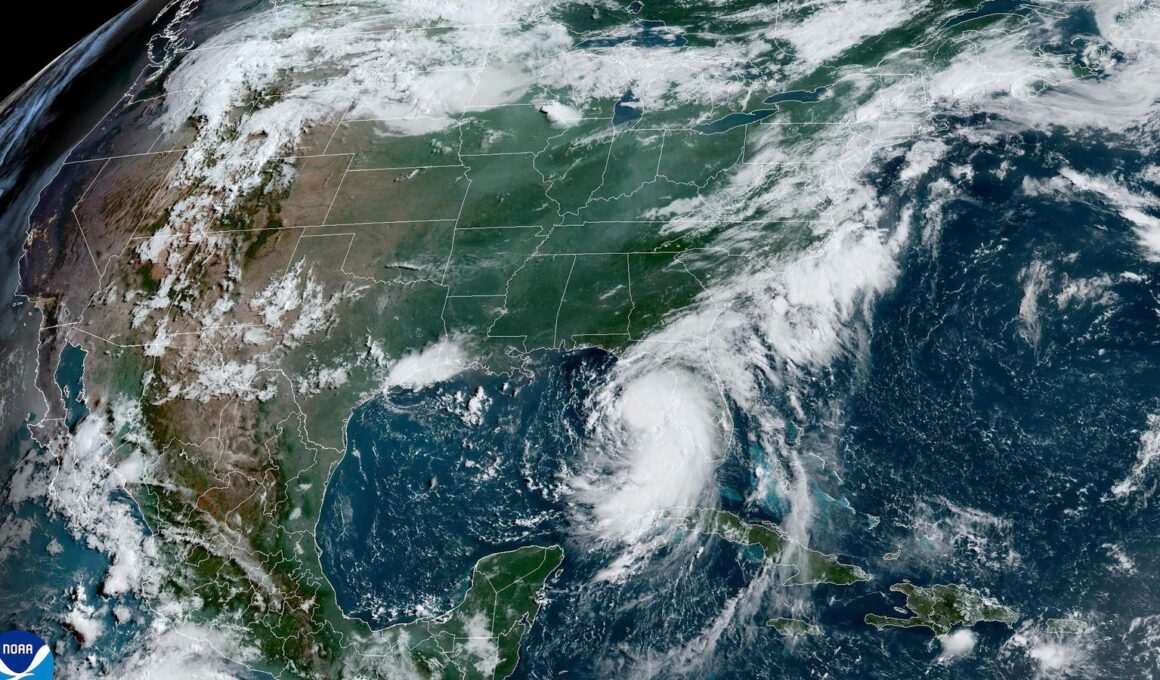
Tropical Storm Debby is making its way to Florida and is expected to strengthen rapidly and become a hurricane before it makes landfall on Monday—sending most of Florida into a state of emergency for the fourth named storm of this hurricane season.
This satellite image provided by NOAA shows Tropical Storm Debby as it moves through the Gulf of … [+]
Key Facts
Tropical Storm Debby is expected to make landfall as a hurricane Monday in Florida’s Big Bend region—which houses cities at the end of the panhandle including Tallahassee, St. Marks and Apalachicola—as the storm moves north off Florida’s Gulf Coast, the National Weather Service said Sunday in its 11 a.m. EDT update.
NWS warned of heavy rainfall in Florida’s Big Bend ( six to 12 inches) and southeast Georgia and South Carolina (10 to 20 inches) that could lead to “catastrophic flooding” through Friday.
The Gulf Coast of Florida is facing the “danger of a life-threatening storm surge” with six to 10 feet of inundation expected on Monday.
While hurricane conditions aren’t expected until Monday, tropical storm conditions including winds ranging from 39-73 miles per hour are expected to begin Sunday evening and last through Monday across Florida.
As of Sunday at 11 a.m., the maximum sustained recorded wind speed of Tropical Storm Debby was 65 mph, according to the weather service.
Florida Gov. Ron Desantis announced much of Florida was in a state of emergency on Thursday ahead of Tropical Storm Debby’s landfall and expanded it to include 61 of Florida’s 67 counties on Friday.
President Joe Biden approved Florida’s emergency declaration on Saturday and ordered federal assistance to help with state, tribal, and local response efforts.
Get Forbes Breaking News Text Alerts: We’re launching text message alerts so you’ll always know the biggest stories shaping the day’s headlines. Text “Alerts” to (201) 335-0739 or sign up here.
What To Watch For
More details on the path of the storm. As of the 11 a.m. update on Sunday, the National Weather Service said there was “significant uncertainty in the track of Debby in the 2-5 day time frame.” Much of the guidance shows the center staying over the southeastern U.S. near Georgia and South Carolina for several days.
Key Background
Meteorologists at the National Oceanic and Atmospheric Administration predicted this year would see the busiest storm season the agency has ever forecasted in the Atlantic region. The forecast is in part due to near-record warm sea surface temperatures—which are often linked to climate change—and the return of La Niña, which will lessen wind shear in the Atlantic Ocean, making conditions more conducive for hurricanes, according to NOAA. The hurricane season officially began on June 1 and runs through November, though hurricanes can occur outside of that window.
Big Number
Between 17 and 25. That’s how many named storms the National Oceanic and Atmospheric Administration predicted we would see this year—far outpacing the average of 14 named storms observed a year over the past three decades.
Further Reading
Israel and Hamas. Previously, she has covered a range of topics from Donald Trump’s legal battles to Taylor Swift’s path to becoming a billionaire. She joined Forbes in April 2022 and is based in Colorado. Prior to joining Forbes, Bohannon covered local news and spent time at the Fort Collins Coloradoan and the Arizona Republic. She graduated with a degree in journalism from Creighton University and has an MA in investigative journalism from Arizona State. Follow Bohannon for continued coverage of pop culture, politics and updates on the war in Gaza.
“>


