CNN
—
Ernesto has regained Category 1 hurricane strength with 75 mph sustained winds Sunday as it headed toward Atlantic Canada, following its thrashing of Puerto Rico and the Virgin Islands, where it left hundreds of thousands of people without power.
Ernesto made landfall on Bermuda early Saturday as a Category 1 hurricane with sustained wind speeds of 85 mph and gusts at 105 mph but had weakened to a tropical storm by early Sunday with maximum sustained winds of 70 mph well northeast of Bermuda, according to the US National Hurricane Center.
Hurricane Ernesto is now located about 520 miles south of Halifax, Nova Scotia, by Sunday evening, the hurricane center said in its 5 p.m. ET update.
“Some additional intensification is forecast over the next 12 hours followed by weakening before Ernesto becomes a post-tropical cyclone on Tuesday,” the hurricane center said.
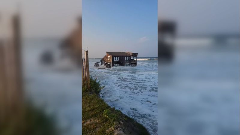
Even though Ernesto was hundreds of miles away from the US coast Sunday, deadly rip currents will be a threat from Florida through Maine Sunday and Monday. Large swells and rough surf continued to be a problem along the East Coast by Sunday evening and left many beaches closed throughout the weekend.
“Life-threatening surf and rip current conditions are likely in these areas during the next couple of days,” the hurricane center warned.
By Monday, the storm will head toward Atlantic Canada, and watches may be required for portions of Newfoundland and Labrador. The Canadian Hurricane Centre said impacts will include moderate to high surf along the Atlantic coast of Nova Scotia, and some rain and moderate winds to southeasternmost Newfoundland.
“There could be some minor damage to docks and coastal structures,” the Canadian Hurricane Centre said.
The Canadian Hurricane Centre issued hurricane-force wind warnings for the Canadian offshore waters of Laurentian Fan and the southwestern Grand Banks for Monday.
Ernesto’s strength late this week was fueled by the extremely warm waters of the Atlantic — a phenomenon becoming more frequent in a world warming due to fossil fuel pollution — but dry air interacting with the system prevented explosive strengthening.
The center of the hurricane moved over Bermuda on Saturday, but drenching rain and tropical storm-force wind gusts were already underway Friday over the tiny island, which is about a third of the size of Washington, DC.
The Bermuda International Airport reported tropical storm-force conditions with sustained winds of 41 mph with a gust to 63 mph, according to the National Hurricane Center.
Tropical storm conditions continued in Bermuda into Saturday evening.
Dangerous surf for Eastern Seaboard
Ernesto continues to have wide-reaching effects despite remaining so far from large land masses.
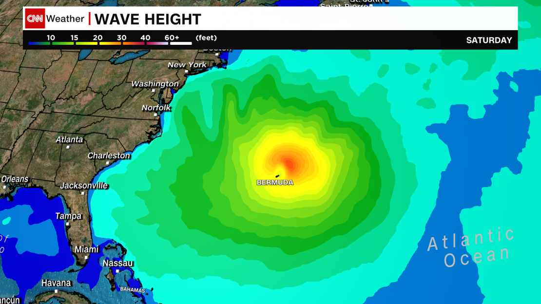
The hurricane will create massive waves — perhaps up to 40 feet high — in the open Atlantic, spreading hundreds of miles away. The elevated wave heights will bring rough seas and dangerous rip currents to the US East Coast, the Bahamas and parts of the Caribbean into early next week.

Two Ohio men are dead, officials say, after getting caught in rip currents hours apart on Hilton Head Island Friday as the hurricane moved north in the Atlantic Ocean.
The drownings happened about five hours apart at separate beaches on Hilton Head, a spokesperson for the Beaufort County Sheriff’s Office, Master Sgt. Daniel Allen, told CNN Saturday.
The first drowning occurred around 10:30 a.m. followed by the second drowning at about 3:20 p.m., Allen said.
Both men were visiting the area from Ohio, according to Allen, who noted beach officials “warned people to be cautious of going out deep in water and to be cautious of rip currents.”
It is unclear whether there was a connection or relation between the two men.
For a majority of the US Atlantic coast, the most dangerous coastal conditions unfolded over the weekend, coinciding with the time many people flock to the beach.
Rip currents can exhaust even the strongest swimmers and turn deadly. At least 29 people have been killed in rip currents this year in the US and its territories, according to the National Weather Service.
Beyond Bermuda, Ernesto will pass close to Atlantic Canada early next week and potentially bring some rain, wind and rough seas.
Outages linger after Ernesto
Ernesto’s center never made landfall over Puerto Rico or the US Virgin Islands but the system’s strong winds still knocked out power to hundreds of thousands of people.
In Puerto Rico, about half the customers on the island were at one point without power Wednesday, according to LUMA Energy, the private company operating the transmission and distribution of power in Puerto Rico. By Friday morning, more than 200,000 were still in the dark, but the island showed signs of recovery by Sunday when nearly 96% of customers were reported to have power, according to LUMA Energy.
In the US Virgin Islands, where just over 10,000 customers were without power Friday morning, the number of affected customers had dropped to around 1,400 by Sunday evening, according to PowerOutage.us.
Heavy rain soaked the Virgin Islands late Tuesday and Wednesday. More than half a foot of rain drenched much of Puerto Rico and caused widespread flash flooding. Some locations recorded nearly a foot of rain from Ernesto: Just over 10 inches of rain fell over a 24-hour period in the mountain town of Barranquitas, according to a preliminary weather service report, while Villalba saw around 9.5 inches.
Intense rainfall and flooding caused several rivers to overflow their banks in Puerto Rico and interrupted water filtration processes at a number of water processing plants to varying degrees, according to the island’s water authority.
Even as Ernesto moved a few hundred miles away from Puerto Rico Wednesday night, water issues worsened. More than 250,000 water customers – about 20% of total customers – were without drinking water Friday morning, according to the island’s emergency portal system.
CNN’s Amanda Musa, Ashley R. Williams and CNN meteorologists Elliana Hebert and Allison Chinchar contributed to this report.


