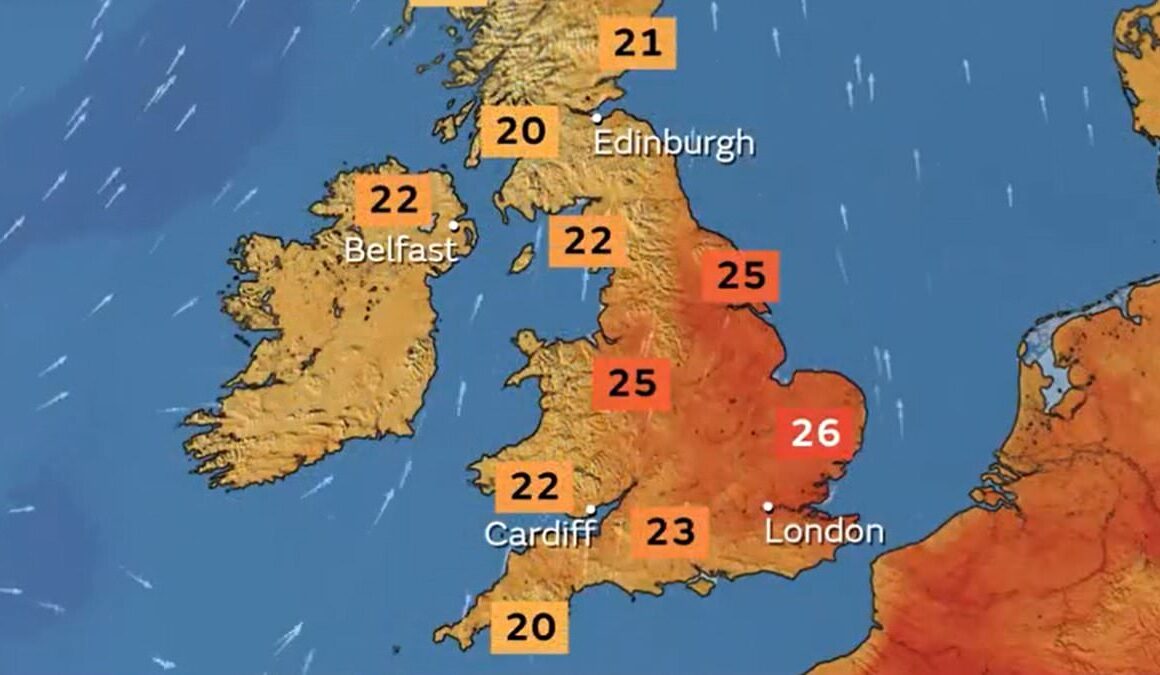
Britain will see a North-South split in the weather this week with southern areas set to enjoy sunshine and 27C (81F) highs but northern parts enduing heavy rain.
The Met Office said temperatures would be warm this week with highs of at least 24C (75F) every day in the South, but it will be slightly below heatwave criteria.
Today will be largely dry in southern parts of the UK with bright or sunny intervals and feeling warmer and more humid than yesterday as temperatures hit 27C (81F).
But outbreaks of rain will affect areas of Scotland, Northern Ireland and North West England today with the rain spreading into western Wales later on.
The Met Office issued a 24-hour yellow weather warning for heavy downpours in western Scotland which runs until 9pm tonight having begun at 9pm last night.


The Met Office issued a rain warning in Scotland between 9pm last night and 9pm tonight


People pack out Weymouth beach in Dorset yesterday on a hot afternoon
Around 1.6in (40mm) of rainfall is expected in some parts with 3in (75mm) or more on higher ground. The average monthly summer rainfall in Scotland is 6in (150mm).
The Met Office warned commuters that spray and flooding may slow down traffic on roads. Buses and trains could by delayed and properties could be flooded.
Tonight will be warm and humid, with rain and possibly thunder moving slowly eastwards then clearer conditions into Scotland and Northern Ireland.
Rain will then move eastwards tomorrow but weaken and clearing eastern areas by late afternoon, before fresher but brighter conditions follow with showers. Highs of 24C (75F) are expected.
The outlook for Wednesday is for bright spells and showers for many along with 24C (75F) temperatures.
Cloud and rain will then move eastwards on Thursday with 25C (77F) highs, then Friday follows with sunshine, showers and 24C (75F) temperatures.
The highest temperatures of the weekend were both recorded at Wisley in Surrey – 24.3C (75.7F) yesterday and 26.3C (79.3F) on Saturday.
Last week, Friday got to 28.3C (82.9F) in Hull. That followed three consecutive days of 30C+ (86F+) temperatures with 30.2C (86.4F) also at Wisley last Thursday, and 31.1C (88.0F) at Brize Norton in Oxfordshire last Wednesday.


It was 32.0C (89.6F) at Kew Gardens and Heathrow in London last Tuesday – which was the hottest day of 2024 so far.
The Met Office said a warm snap is considered a heatwave if a location records at least three consecutive days with maximum temperatures exceeding a designated value.
This is 25C (77F) for most of the UK – rising to 28C (82F) in London and its surrounding area, where temperatures are typically higher.
The place in the UK that saw the longest run of hot weather last week was East Malling in Kent where the heatwave lasted at least five days in a row between Sunday, July 28 and last Thursday.
The highest temperature in the UK last year was 33.5C (92.3F) at Faversham in Kent on September 10.


